DJI and AirMap Deliver Real-Time Wildfire Awareness and Geofencing Capabilities for Drones
Reliable, Real-Time Awareness of Wildfires Reduces Drone Interference for Operators and Firefighters
SANTA MONICA, Calif., July 14, 2016 /PRNewswire/ -- DJI, the world's leading maker of unmanned aerial vehicles, and AirMap, the world's leading provider of airspace intelligence and navigation services to unmanned aircraft, added real-time wildfire alerts to their geofencing data Wednesday to help keep unauthorized drones from interfering with firefighting operations.
AirMap now obtains wildfire information directly from the U.S. Department of the Interior's incident command system and immediately pushes it to drone pilots through AirMap's iOS and web apps, AirMap's API, and the GEO geofencing system included in the DJI GO flight control app. This data is more current and includes more active wildfires than Temporary Flight Restrictions (TFRs) published by the Federal Aviation Administration (FAA).
"AirMap delivers dynamic airspace intelligence to unmanned aircraft in order to provide the safest operating environment possible," said Ben Marcus, CEO of AirMap. "Through our partnership with DJI and other drone manufacturers and application developers, more than 70 percent of the drones operated in the United States now benefit from wildfire information in real time."
"DJI wants to equip its customers with safety-critical information that will help our first responders, whether or not a TFR has been issued," said Brendan Schulman, DJI Vice President of Policy and Legal Affairs. "This enhancement to GEO will help prevent DJI drones from inadvertently taking off within, or flying into, a wildfire location without authorization."
Unauthorized drones near wildfires can pose a hazard to firefighting airplanes and helicopters, and in some cases they have forced aerial firefighting operations to be suspended. AirMap's new wildfire alerts are designed to help drone operators understand the hazards and restrictions near them when deciding whether it is safe to fly.
The Department of the Interior records 300 new wildfires each day during summer fire season, rising above 500 new fires on the busiest days. The vast majority of wildfires start and spread faster than the time it takes to communicate and post the hazard as a TFR. Often, fires are extinguished before the TFR is issued, and in approximately half of those cases, the fires have been fought by specialized airplanes and helicopters.
DJI is integrating the new AirMap wildfire alerts into the GEO geofencing system in the DJI GO app, which helps pilots avoid flying drones near airports, prisons, nuclear power power plants and other sensitive locations without authorization. DJI pioneered geofencing technology three years ago and has been steadily refining the industry's best technology to enhance aviation safety.
More information about DJI's geofencing system is available at http://www.dji.com/flysafe/geo-system. More information about AirMap's airspace intelligence services is available at airmap.com.
About DJI
DJI is a global leader in developing and manufacturing innovative drone and camera technology for commercial and recreational use. DJI was founded and is run by people with a passion for remote-controlled helicopters and experts in flight-control technology and camera stabilization. The company is dedicated to making aerial photography and filmmaking equipment and platforms more reliable and easier to use for creators and innovators around the world. DJI's global operations currently span North America, Europe and Asia, and its revolutionary products and solutions have been chosen by customers in over 100 countries; for applications in film, advertising, construction, fire fighting, farming, and many other industries.
About AirMap
AirMap is the world's leading provider of airspace information and services for unmanned aircraft, commonly known as drones. Developed by experts in drone technology, aviation, and policy, AirMap's cutting-edge technology transforms airspace below 500 feet to create an interconnected drone ecosystem. AirMap provides accurate, reliable, and trustworthy low-altitude navigational data and communication tools to the drone industry: inventors of drones & drone technology, drone operators, and airspace stakeholders. AirMap has a rapidly expanding global network of hundreds of partners and thousands of app users. For more information, visit www.airmap.com.
Featured Product
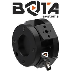
Bota Systems - The SensONE 6-axis force torque sensor for robots
Our Bota Systems force torque sensors, like the SensONE, are designed for collaborative and industrial robots. It enables human machine interaction, provides force, vision and inertia data and offers "plug and work" foll all platforms. The compact design is dustproof and water-resistant. The ISO 9409-1-50-4-M6 mounting flange makes integrating the SensONE sensor with robots extremely easy.
No adapter is needed, only fasteners! The SensONE sensor is a one of its kind product and the best solution for force feedback applications and collaborative robots at its price. The SensONE is available in two communication options and includes software integration with TwinCAT, ROS, LabVIEW and MATLAB®.
