PrecisionHawk Launches Free PrecisionMapper Software for Drone Mapping
Now drone operators can stitch an unlimited number of photos, create maps without resolution limits and run algorithms to analyze their data for free
RALEIGH, N.C., May 9, 2017 /PRNewswire/ -- PrecisionHawk, a leading commercial drone and data company, has opened access to its professional mapping and analytics software, PrecisionMapper, for free. By eliminating the cost barrier, operators have the flexibility to 'bring their own drone' and consistently generate value from aerial information.
"Drones have the potential to capture more high-resolution data than any other technology, but we believe that drones are being under-utilized because of the cost barriers around processing, analytics and storage," said PrecisionHawk CEO Michael Chasen. "Users should be able to walk into any store, buy a drone and use that drone to generate business insights for free."
PrecisionHawk announced the launch of the free version of PrecisionMapper today at the AUVSI Unmanned Systems conference.
"We believe that this move allows more innovation from more people," Chasen continued. "PrecisionHawk has gained a lot from the advanced thinking of this community, and this is our way of giving back."
By providing this software for free, PrecisionHawk is giving operators of drones with visual cameras the capability to explore the financial value of aerial data in any industry and is encouraging further use and adoption of drone technology.
Operators can quickly and easily upload imagery collected from a drone to PrecisionMapper. Using GPS information embedded within images, the software automatically stitches together a complete map, viewable in both 2D and 3D. Free users of PrecisionMapper can create up to 60 surveys a year without resolution or export limits.
In addition, users can add ground control points and access free analysis tools for construction, agriculture, insurance, and energy including:
Volume calculations
3D Models
Contour Maps
Multiple Crop Health Indices, including visual-NDVI
"When professionals have the opportunity to get hands-on experience with PrecisionMapper, they will be able to better understand the power of aerial data and how it can be best incorporated into their existing businesses," said Chasen.
For more information, or to create a free account and start using PrecisionMapper, please visit precisionhawk.com/precisionmapper.
About PrecisionHawk Inc.
PrecisionHawk is a leading provider of advanced commercial drone technologies. The company, founded in 2010, is privately held and located in Raleigh, NC and Toronto, Canada. PrecisionHawk's client list of Fortune 500 companies and market-leading innovators spans 150 countries and the company has existing operations across six continents. PrecisionHawk is funded by leading venture capital firms and global technology investors including Intel Capital, Millennium Technology Value Partners, Verizon Ventures, a subsidiary of USAA, NTT Docomo Ventures, Yamaha Motor, DuPont and Indiana University. More information about PrecisionHawk can be found at www.precisionhawk.com or on Twitter @PrecisionHawk.
Featured Product
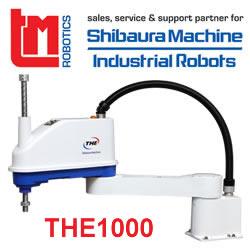
TM Robotics - Shibaura Machine THE SCARA range
The THE range from Shibaura Machine is an extensive line up of SCARA robots. Available in four arm lengths THE400 (400mm), THE600 (600mm) and the most recent THE800 (800mm) and THE1000 (1000mm), this range is suitable for assembly, handling, inspection and pick and place processes in varied industrial applications. The THE1000 boasts a 20kg payload capacity and an impressive 0.44 second cycle time, providing high speeds for processes with large components. In fact, the range has been recognised for as the price-to-performance leader compared to other SCARA models in its price range due to its impressive speed versus payload capacity.
