Skyward Releases Automated Flight Modes for Drones
New Survey, Orbit and Point to Point Modes simplify workflow and enable advanced operations for pre-planned missions and surveys
Today, Skyward, A Verizon company and builder of software and airborne connectivity services providing the next level of operational control, announced Automated Flight Modes for pre-planned missions and surveys, which is the newest feature for Skyward's InFlight mobile app.
Automated Flight Modes enable Skyward subscribers to fly automated missions, collect imagery, data, or videography, and automatically log flights to Skyward, all without ever leaving InFlight. These pre-programmed flights can be easily reviewed before takeoff, and the images collected can be processed using any major drone mapping software. It's one more piece in a complete drone management solution.
Overview of InFlight's Automated Flight Modes
InFlight includes three Automated Flight Modes:
Survey
Survey provides users the ability to automatically create a flight path for three-dimensional mapping based on your area of operation. With an intuitive user interface, Survey mode calculates a flight path along a survey grid and controls the drone as it autonomously flies the mission. Advanced controls provide users the ability to fine tune the flight parameters for optimal data collection.
After the flight, the images collected can be turned into 3D maps using the post-processing platform of your choice — the data is compatible with any major drone mapping software. Survey is a great fit for companies conducting orthomosaic or LiDAR point cloud surveys.
Orbit
Orbit creates an automated path around a point of interest, allowing the user to smoothly capture a video from all angles. The drone's flight path can be adjusted according to precise parameters for optimal photo or video capture.
Orbit provides 360-degree footage of a site or structure, and the images collected can be used to help create 3D models.
Point to Point
With Point to Point, users can create a path of points for the drone to fly along automatically. Users can modify the parameters of this path to optimize the footage collected. Using Point to Point, crews can lay out exact flight paths to execute a mission even before deploying to the field.
Point to Point missions can be executed for a diverse array of use cases, including surveying, inspection, and construction progress tracking. It brings the next step toward autonomy into Skyward.
Simplifying the drone workflow with Skyward
With the addition of Automated Flight Modes, Skyward customers can simplify the workflow by managing their entire mission in the field using InFlight. Users can plan flights, request airspace permission, run a risk assessment, and control a flight. Operations in progress can be monitored with live flight tracking. And all your flight logs, whether manually controlled or automated, are automatically saved to Skyward's Drone Management Platform for later review.
Automated Flight Modes also allow for more advanced operation profiles. Customers can complete missions of greater complexity than ever before through Skyward, with incredible ease of use.
Featured Product
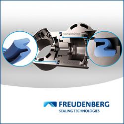
IP Seals for Robots
Freudenberg Sealing Technologies' IPRS (Ingress Protection Seals for Robots) provides reliable protection for robotic systems operating in harsh environments. Designed to prevent dust, moisture, chemicals, and wear from compromising performance, IPRS extends service life and reduces maintenance. The adaptive Z-shaped geometry ensures sealing integrity under continuous motion, making it ideal for high-speed automation and outdoor applications. Manufactured with high-performance elastomers such as Fluoroprene XP and EPDM, IPRS offers exceptional resistance to lubricants, cleaning agents, and extreme temperatures. This makes it the perfect solution for six-axis robots, SCARA robots, AMRs, AGVs, and cobots.
With its low-friction design and durable materials, IPRS enhances energy efficiency and operational reliability in industrial and autonomous robotics. Learn more about our IPRS Seals
