Five reasons why machines need eyes
Machines are performing more and higher-level functions every year and with greater autonomy. But autonomous or not, for many of these machines to operate effectively and safely, they need the ability to accurately judge range and see. Here are just a few reasons why machines need eyes. By Philip Constantine, CEO LightWare LiDAR LLC
Machines are performing more and higher-level functions every year, and with greater autonomy. But autonomous or not, for many of these machines to operate effectively and safely, they need the ability to accurately judge range and see. Here's just a few reasons why machines need eyes:
1. For drones to maintain the right altitude
With miniaturization and cost reductions in LiDAR units, it's become feasible to integrate one on every drone. And while it's something we perhaps don't think about as much, accurate altimetry is crucial in the safe and efficient operation of drones and other unmanned aerial vehicles (UAVs). LiDAR systems are accurate over all terrain types and water, function in all weather conditions, and are effective at night. Altimetry isn't just for collision avoidance, it also enables safe take-off and landing - essential under any circumstances, but increasingly so for drones to perform deliveries. Think of drones delivering packages in busy urban areas, needing to navigate over houses, streetlamps, and vehicles; or those delivering crucial medical supplies to remote communities over uneven terrain not easily accessible, and you'll understand the crucial role LiDAR can play.
2. For us to explore other planets
We haven't yet managed to send astronauts to Mars, and it's been almost half a century since anyone last visited the moon, but when we get round to it, we won't be alone. The Valkyrie, also known as Robonaut 5, is a robot designed by NASA to assist on crewed missions to satellites or planets. Its tasks would include building bases, assembling other equipment, and performing maintenance. It can use human tools and navigate difficult terrain thanks to its built-in LiDAR system, which works in conjunction with a pair of cameras to enable remote or automatic navigation. While we wait for those missions, however, NASA's Ingenuity is a small robotic helicopter deployed with the Perseverance mission to Mars that has already flown over uncharted, uneven Martian terrain in incredibly challenging conditions. Its LiDAR altimeter has ensured the craft has successfully completed more than a dozen flights, demonstrating that flight on Mars is possible.
3. For robots to better navigate warehouses
Given that warehouse management is all about efficiency, it's no surprise that robotic systems have seen growing adoption in this space. Robots are being used to increase picking efficiency, make up for labor shortages and decrease workforce costs, improve safety, as well as free up employees to perform tasks that require real brainpower. Of course, to do all these things without becoming more of a nuisance than help, such robots need the ability to map their surroundings accurately and quickly. LiDAR offers advantages in this regard. It operates at a high resolution, enabling robots to avoid even small obstacles. Combined with Simultaneous Localization and Mapping (SLAM) software - which allows robots to perform in GPS denied areas, like under a roof - a robot can create a map of its surroundings and locate its position within that, enabling dynamic path planning and obstacle avoidance. LiDAR also performs well in variable lighting conditions, making it a capable tool for dark warehouse corners and bright environments alike.
4. To help find missing people
LiDAR is efficient at mapping terrain, functions effectively in poor light and is unaffected by inclement weather. This makes it an ideal tool for search and rescue operations - which by their very nature often take place in mountains, poor visibility, and bad weather (it's hard to get lost in a flat field on a sunny day). Drones equipped with LiDAR senses are being tested to speed up search and rescue by locating missing persons and mapping out terrain, which helps plan the safest and most efficient route to rescue. They can search effectively under dense forest canopies, for example, which often interfere with conventional GPS guidance systems. Researchers have also developed algorithms that help the drones identify areas already searched, to increase efficiency. For water-based operations, bathymetric LiDAR sensors can be used, which pulse a low-frequency laser that reflects off the water's surface, and a high-frequency laser that penetrates the surface and reflects off the ocean floor or riverbed. This enables both effective location of partially submerged objects or people and mapping of the depth of the body of water. The applications of LiDAR for other scenarios, such as snow, fog, or even burning buildings or forests, are clear.
5. To understand climate change
There's no doubting human vision is superior to that of machines, and it will likely remain so indefinitely. But machines can see things we can't, like atmospheric gases. Although lasers have been used in meteorological applications since the 1960s, recent advancements have enabled more advanced studies of the interactions between gases like ozone and water vapor in the tropopause - the layer that separates the troposphere, which borders the surface and produces weather; and the stratosphere, which contains the protective ozone layer. LiDAR's crucial advantage is that it allows for greater vertical resolution than ever before, essential for understanding the interactions between gases in atmospheric boundaries and their impact on climate - ultimately leading to more accurate climate change modelling.
How does LiDAR help machines see?
LiDAR, which stands for "light detection and ranging", does indeed enable machines to see, but not in the same way that a camera does. LiDAR rapidly pulses lasers of different wavelengths into the environment, measuring the time taken for these lasers to reflect off objects, to form a highly detailed map of its surroundings. Because its light source is an integrated part of the unit, LiDAR is unaffected by changes in ambient light or weather - a key advantage in a range of applications. Also, as LiDAR detects objects and does not "see" images, there is no concern around privacy intrusion.
Featured Product
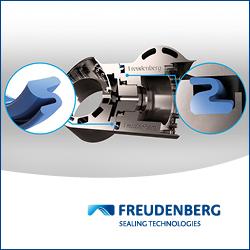
IP Seals for Robots
Freudenberg Sealing Technologies' IPRS (Ingress Protection Seals for Robots) provides reliable protection for robotic systems operating in harsh environments. Designed to prevent dust, moisture, chemicals, and wear from compromising performance, IPRS extends service life and reduces maintenance. The adaptive Z-shaped geometry ensures sealing integrity under continuous motion, making it ideal for high-speed automation and outdoor applications. Manufactured with high-performance elastomers such as Fluoroprene XP and EPDM, IPRS offers exceptional resistance to lubricants, cleaning agents, and extreme temperatures. This makes it the perfect solution for six-axis robots, SCARA robots, AMRs, AGVs, and cobots.
With its low-friction design and durable materials, IPRS enhances energy efficiency and operational reliability in industrial and autonomous robotics. Learn more about our IPRS Seals
