Laser Scanning Drones: XactSense is First to Fly Velodyne's New Low-Cost LIDAR “Puck”
XactSense inc. has developed a new platform for low-altitude aerial mapping using the newly released Velodyne LIDAR VLP-16 “Puck”. Drone LIDAR mapping for the masses is here.
Providence, Rhode Island March 02, 2015
XactSense inc. has developed a new platform for low-altitude aerial mapping using the newly released Velodyne LIDAR VLP-16 "Puck". Drone LIDAR mapping for the masses is here.
The new multi-laser puck builds on Velodynes reputation for small lightweight LIDAR and XactSenses founder, Andy Trench, knows that this next-gen sensor is a game changer. Companies of all sizes can now afford to utilize this emergent drone technology. In anticipation of the low-cost laser's release, XactSense designed a new adaptable folding 8-rotor UAV called the "MAX8." This platform integrated the industry's only electro-stabilized LIDAR gimbal with thermal and high resolution cameras, vastly outperforming other systems we've seen in terms of features and flexibility. The resulting mapping drone is the lowest-cost option for people looking for more than just a photo or video from their UAV investment.
"Weve been dying to get our hands on this new, smaller sensor. The amount of calls we are fielding from the mapping and surveying industry for an aerial system like this is astounding, and we are excited to offer a solution that allows many more companies to consider UAV a must-have technology in their toolbox." - Andy Trench, Founder, XactSense Inc.
Trenchs new system is ideal for a wide variety of missions including gas pipe line inspection, DOT and engineering projects, power line corridor mapping, and cell tower surveying.
XactSense inc. offers turnkey UAV aircraft, geospatial scanning, and sensor integration solutions. Their GPS-Free UAV surveying platform gained XactSense national recognition as robotics and disruptive technology innovators in a rapidly growing market. XactSense is often seen showing off their real-time mapping to an eager audience at conferences like the International LIDAR Mapping Forum ( ILMF ). They will also be impressing the crowds at the upcoming SPAR and AUVSI tradeshows, alongside other forward thinking companies like drone deploy, Skycatch, and Airware.
XactSense will be a company to watch closely while drones gain traction as the fastest growing technology in this decade.
"We were very impressed with [Andys] demonstration of the XactSense Titan/HDL-32E platform at our California headquarters earlier this year. His integration of our recently released VLP-16 in a very short amount of time is almost unbeatable." - Wolfgang Juchmann, Director of Sales & Marketing at Velodyne's LiDAR division.
About XactSense:
XactSense Inc, formerly Xactmaps, is a UAV hardware and software company focused on developing modern solutions for tomorrows data driven world. With advancements in LIDAR collection software, payload integration, and UAV design. XactSense has made great progress in a very short time. Their team consists of experienced UAV operators, computer vision experts, electrical engineers, and successful business developers.
Andy Trench is a Designer, Engineer, RC enthusiast, Inventor and Entrepreneur. He has made innovations in aerial filming, stabilized camera platforms, and film production befor turning his attention to spatial data collection with photogrammetry and LIDAR. His creative approaches to UAV technology have him refining where others are just now starting out.
More about the XactSense new MAX8 platform and LIDAR payload can be seen here: http://www.xactsense.com/products
XactSense SLAMsense GPS-Free LIDAR data collection example can be seen here: https://vimeo.com/101643115
Featured Product

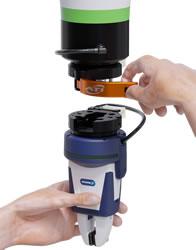
ATI Industrial Automation - MC-50 Manual Tool Changer
With intuitive and ergonomic lever operation, the patent-pending MC-50 Manual Robot Tool Changer provides a simple solution for quickly changing robotic end-of-arm tooling by hand. This compact and robust Tool Changer is designed for applications on collaborative robots that support payloads up to 25 kg and small industrial robots supporting payloads up to 10 kg. Featuring an ISO 50 mm mounting interface on the Master-side and Tool-side, the low-profile MC-50 mounts directly to most cobots and seamlessly integrates with many common cobot marketplace grippers and end-effectors.
