Velodyne LiDAR Partners with YellowScan for Integrated LiDAR for UAVs
YellowScan to leverage Velodynes lightweight VLP-16 Puck LiDAR sensors for its advanced aerial Surveyor LiDAR system
SAN JOSE, Calif.--(BUSINESS WIRE)--Velodyne LiDAR Inc., the world leader in 3D vision systems for autonomous vehicles, today announced that it is partnering with YellowScan to integrate its VLP-16 Puck and VLP-16 Puck LITE LiDAR sensors into YellowScans Surveyor for a turn-key and reliable LiDAR system for demanding UAV applications.
Real-time LiDAR systems for UAVs are leveraged around the world for industrial and scientific applications, including surveying, civil engineering, archeology, and environmental science, requiring YellowScans ultra-compact 3D laser mapping solutions. By combining its LiveStation app with the unbeatable real-time 3D data capture capabilities of Velodynes VLP-16 Puck and VLP-16 Puck LITE sensors - both of which feature a 360° horizontal field-of-view (FoV), 100-meter range, and weighing in at just 830 grams and 590 grams, respectively - YellowScan delivers a turn-key Surveyor system that can be mounted to any drone for short-time data processing needs. The result is a real-time in-flight LiDAR monitoring platform, with users able to see how the final map is being generated in real-time during the drone mission, and the basic map datasets available immediately after the mission.
"YellowScan is known for its commitment to providing reliable and easy to use sensing solutions for the UAV industry, which make the VLP-16 Puck sensors an easy choice for the Surveyor system," said Erich Smidt, Executive Director Europe, Velodyne LiDAR. "The VLP-16 Pucks are some of our newest offerings, with significant effort put into reducing weight while maintaining the resolution and reliability expected of Velodynes industry-leading LiDAR sensors."
"YellowScan Surveyor, the turn-key LiDAR solution integrating Velodynes advanced VLP-16 sensor, enables mapping professionals to do more in less time thanks to tremendously high density and accurate measurements acquired from UAVs," said Tristan Allouis, CTO, YellowScan.
YellowScan will showcase the Surveyor LiDAR system at the Commercial UAV Expo in Las Vegas on October 24-26. The company will also host a standalone demo on October 27 from 10 am to 2 pm at the College of Southern Nevada in Henderson, Nevada, where participants will see what its like to launch and recover a UAV equipped with a YellowScan Surveyor. In addition, participants will see how the sensor covers the Area of Interest (AOI) via LiveStation and how to process the files post flight into a point cloud.
About Velodyne LiDAR
Founded in 1983 and headquartered in Silicon Valley, Velodyne is a technology company known worldwide for its real-time 3D LiDAR sensors. The company evolved after founder/inventor David Hall developed the HDL-64 Solid-State Hybrid LiDAR sensor in 2005. Since then, Velodyne LiDAR Inc. emerged as the unmatched market leader of real-time 3D vision systems used in a variety of commercial applications including autonomous vehicles, vehicle safety systems, mobile mapping, aerial mapping, and security. Its products range from the high-performance, surround view Ultra-Puck™ VLP-32, classic HDL-32/64 and cost-effective VLP-16, to the upcoming, hidden Velarray™. Velodynes rich suite of perception software and algorithms are the key enablers of its perception systems. Velodyne supports customers from offices in San Jose, Detroit, Frankfurt, and Beijing. For more information, visit http://www.velodynelidar.com.
About YellowScan
YellowScan designs, develops, and produces UAV Mapping solutions for professional applications. Fully integrated, ultra-light and easy to use, these highly automated data collection tools are used by customers around the world in fields such as surveying, forestry, environmental research, archeology, corridor mapping, civil engineering and mining. With more than 10 years of field experience, YellowScan is committed to delivering the highest level of performance, reliability and robustness for its solutions. Our platforms are field tested all over the world in multiple environments (tropical forest, bare soil, mountains, rivers, coast lines, open-pit mine, power lines). For more information please navigate to www.yellowscan.fr or contact us atcontact@yellowscan.fr.
Featured Product
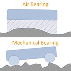
PI USA - 7 Reasons Why Air Bearings Outperform Mechanical Bearings
Motion system designers often ask the question whether to employ mechanical bearings or air bearings. Air bearings deserve a second look when application requirements include lifetime, precision, particle generation, reproducibility, angular accuracy, runout, straightness, and flatness.
